Every boater I know remembers the first time they second-guessed a channel marker. You're idling out of an unfamiliar harbor, you spot a red triangle and a green square in the distance, and your brain starts cycling through that old phrase 'red right returning' — and then suddenly you're not sure if you're returning, or which red, or whether you should be steering between them at all. The instinct is to slow down. The instinct is right. Misreading buoys is one of the fastest ways to put a boat on the bottom.
The good news is the system is far simpler than it looks once you've got the basics. The U.S. Aids to Navigation System — the same one used by the Coast Guard — is built around a small set of shapes, colors, and numbers that work together to tell you where the safe water is. Once you know how to read them, even unfamiliar harbors stop feeling like a maze.
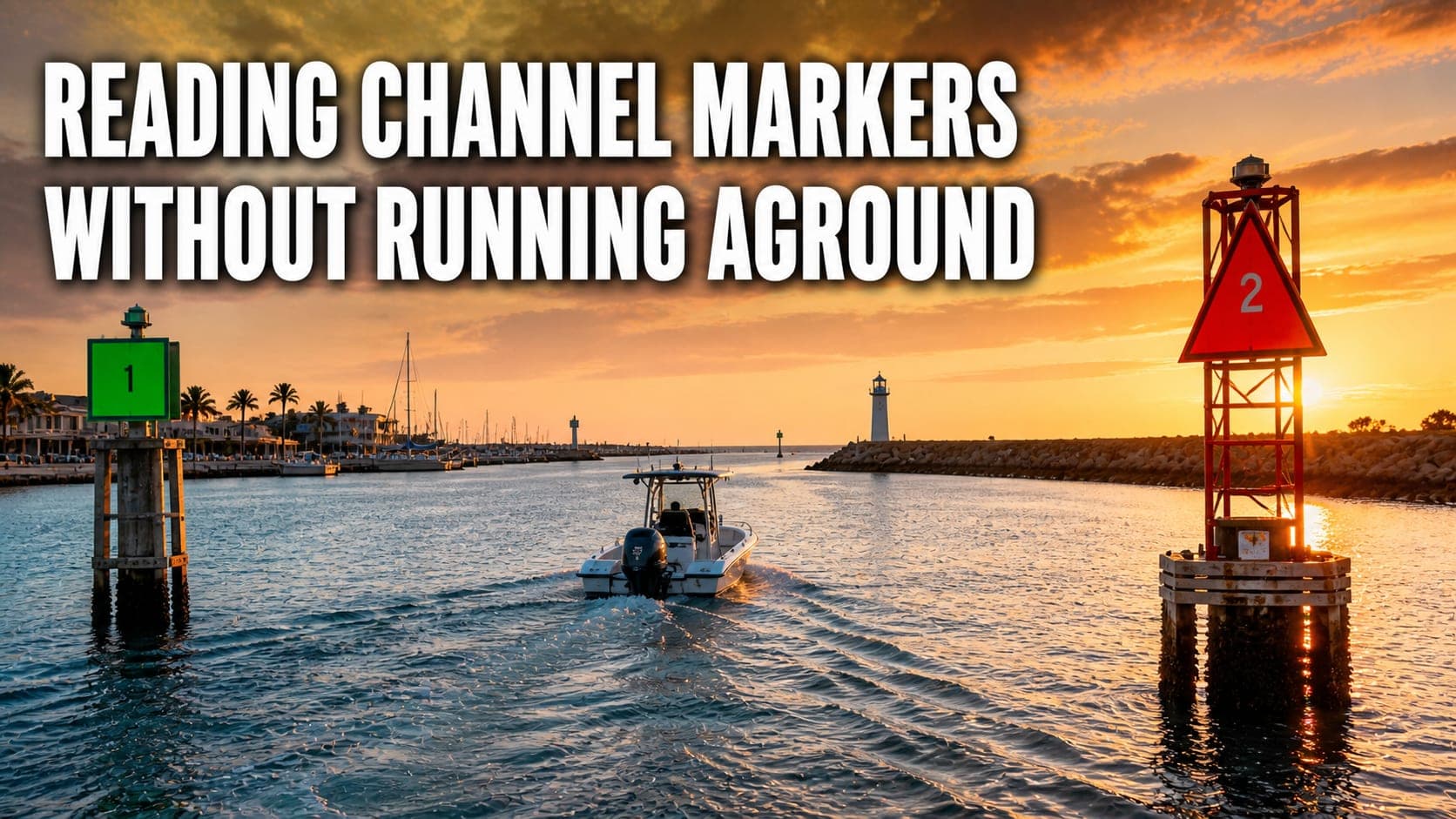
Red Right Returning — and What 'Returning' Actually Means
The phrase you've heard a hundred times is correct, but it only works if you know which direction counts as 'returning.' In the U.S., returning means you're heading from open water (the sea) back toward the harbor or up a river — moving inland. When you're returning, the red markers should be on your right (starboard) and the green ones on your left (port). When you're heading the other way, out toward the ocean, that flips: red on your left, green on your right.
Red markers are always triangle-shaped (called nuns) and even-numbered. Green markers are square-shaped (called cans) and odd-numbered. The numbers count up as you head inland, so a red '6' should appear after a red '4.' If the numbers are running the wrong direction for the way you're going, that's a strong hint you've misread which way is 'in.'
Lateral, Cardinal, and Special Markers
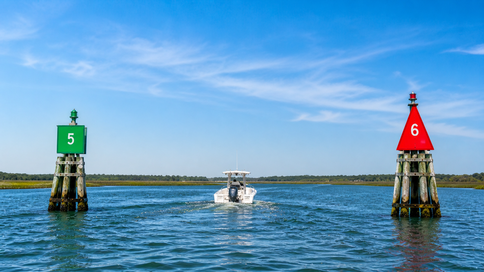
Red and green markers — the ones we've been talking about — are called lateral markers. They define the edges of a navigable channel. The safe water is between them. Stay between the reds and greens and you're in the dredged or naturally deep part of the waterway. Step outside that line and you're trusting your chart and depth sounder, which is a fine thing to do if you've actually checked them.
Cardinal markers are less common in U.S. waters but worth knowing — they use yellow and black bands to point you toward the safe side of an obstruction (north, south, east, or west of the danger). Special markers are yellow and mark things like anchorage areas, fish farms, or restricted zones; they're informational, not directional. White-and-orange markers are regulatory — they tell you about no-wake zones, swim areas, hazards, or rocks. Read what's written on them; the orange shapes (circle, diamond, square) tell you what kind of restriction or warning you're looking at.
Anywhere you see a tall daymark on a piling — a red triangle or green square mounted on a post sticking out of the water — treat it the same as a floating buoy. Same colors, same rules, just permanently fixed.
What Buoy Lights and Numbers Tell You at Night
Lit buoys add a layer of information you'll need the moment the sun goes down. Red lights mark red buoys; green lights mark green buoys. If you see a flashing light pattern — quick flashes, long flashes, groups of two or three — that pattern is printed on the chart next to the symbol for that buoy, so you can confirm you're looking at the right marker. A 'flashing 4 second' green is a different buoy than a 'quick flashing' green right next to it, and the chart is the only way to tell them apart from a mile out at night.
If you're new to night running, don't guess. Slow to idle, pull up the chart, and confirm what you're looking at before you commit. This is a skill where reading marine weather conditions ahead of time matters too — fog and reduced visibility turn an easy daytime channel into a place where the difference between a red 6 and a red 8 means the difference between deep water and a mud flat.
Practical Reading on the Water
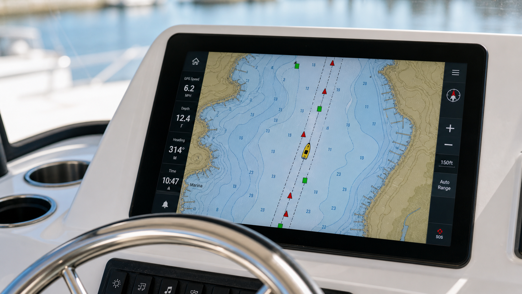
When you approach an unfamiliar channel, look for the first pair of markers and identify which is red and which is green before you commit to an angle. Match that pair to the entrance shown on your chart plotter. Confirm the numbers count up the way you expect for the direction you're heading. Once you've got that first pair sorted, the rest of the channel becomes a sequence — you should be able to anticipate the next number and color before you see it.
Pay attention to the current. In a strong tidal area, a buoy can lean noticeably or even drag a few feet from where the chart shows it. The colors and numbers don't lie, but exact positions sometimes shift between maintenance cycles. If a buoy looks meaningfully off-station, trust the chart's intended position and your depth sounder over the buoy itself, and report it to the Coast Guard so they can fix it.
Tides matter here too. A channel that's wide and forgiving at high water can pinch tight at low tide, and a marker that's well outside the deep cut at high tide can put you on the bottom if you cut the corner at low. Pair this with a real understanding of tides and currents before you depart and you'll stop guessing and start planning.
When in Doubt, Slow Down
Here's the rule I give every new boater: if you're not sure what a marker is telling you, drop to idle, take a beat, and look at the chart. There is no prize for guessing fast. The boat ahead of you cutting hard between two buoys may know exactly what they're doing — or they may be three feet off the bottom and about to learn an expensive lesson. Don't follow other boats blindly through unfamiliar water.
Reading buoys becomes second nature within a season or two of paying attention. Until then, treat every channel like a problem worth solving slowly. Get the basics right and you'll never grind a lower unit on a sandbar with a marker sitting fifty feet to your right, telling you exactly where you should have been.
Closing Thought
Channel markers are the most reliable navigation tool you've got — more dependable than your chart plotter, more honest than your memory of the harbor, and visible in conditions where instruments start to lie. Learn to read them well and a huge chunk of the anxiety of running unfamiliar water just disappears.
If you've had a close call with a misread buoy — or a near-miss that taught you something — drop the story in the comments. The best lessons in boating come from other people's almost-disasters, and we all benefit from sharing them.
