If you’ve ever pulled into an anchorage with plenty of water under you only to wake up resting on the bottom, or fought a current so hard your engine could barely make headway, you already know that tides and currents are not something you can afford to ignore. The water is always moving — and whether that movement helps you or hurts you depends almost entirely on whether you understood it before you untied the lines.
Reading tides and currents is one of those foundational seamanship skills that gets glossed over in boating courses but matters every single time you go out. Here’s what you need to know to read them correctly and use them to your advantage.
What Tides Actually Are — and Why They Change
A tide is the rise and fall of sea level caused by the gravitational pull of the moon and, to a lesser extent, the sun. As the moon orbits Earth, it pulls ocean water toward it, creating a bulge of higher water on the side of the Earth closest to the moon and a corresponding bulge on the opposite side. The result is roughly two high tides and two low tides every 24 hours — though the timing and height vary considerably depending on your location.
What most boaters miss is that tidal patterns are highly local. The tidal range in Maine can be 12 feet or more, while in parts of the Gulf of Mexico it might only be a foot. An anchorage that’s perfectly safe at high tide can leave you aground at low. That’s why you never rely on general knowledge — you always check the tide table for the specific area you’re boating in.
How to Read a Tide Chart Without the Confusion
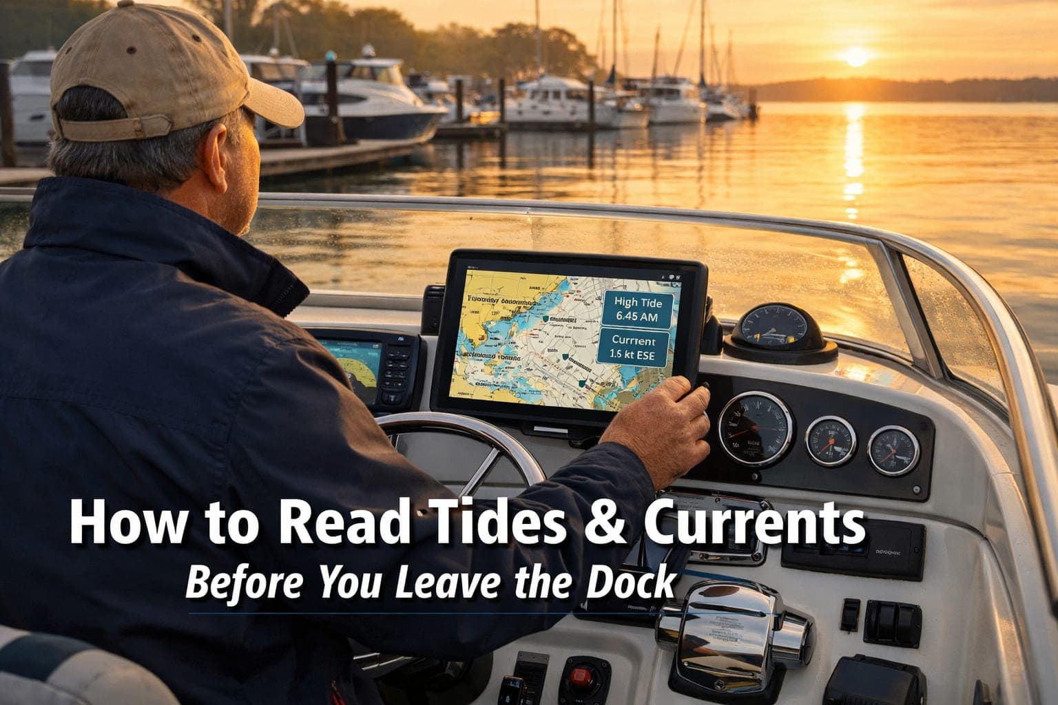
Tide charts look complicated at first glance, but the core information is simple: they show you the predicted height of the water at a specific location at specific times throughout the day. The heights are measured from a baseline called Mean Lower Low Water (MLLW) — essentially the average of the lowest low tides. So when a chart says high tide is 5.4 feet, that means the water will be 5.4 feet above that baseline.
What you’re looking for: check the high and low tide times so you know when you have maximum and minimum depth. If your anchorage has 8 feet of water at high tide and your boat draws 4 feet, you’re fine — but if the tidal range is 6 feet, you’ve got a problem at low tide. Always subtract the tidal range from your high-tide depth before committing to an anchorage. Add a safety buffer of at least a foot.
The rule of twelfths is a quick mental model for estimating how fast the tide is moving between high and low. In the first hour after high or low, the water changes by about 1/12 of the total tidal range. In the second hour, 2/12. In the third and fourth hours, 3/12 each. In the fifth, 2/12. In the sixth, 1/12. This means the water moves fastest in the middle of the tidal cycle — which matters when you’re timing a passage through a shallow inlet. I cover more of these foundational boating skills for new skippers in my beginner’s guide if you want to dig deeper.

A chartplotter displaying tidal data helps you plan safer passages
Currents Are Not the Same as Tides
Here’s where a lot of boaters get confused: tides and currents are related but they’re not the same thing. A tide is the vertical change in water level. A current is the horizontal movement of water that results from that change. In most places, tidal currents flood (flow toward land) as the tide rises and ebb (flow away from land) as it falls — but the timing doesn’t always line up with the tide itself. Current can continue flowing in one direction even after the tide has technically turned.
In channels, inlets, and narrow passes, currents can be surprisingly powerful. A 3-knot current running against you in a boat doing 6 knots means you’re only making 3 knots over ground — and burning twice the fuel to do it. Time your passage with the current behind you and you’ve just doubled your effective speed and halved your fuel burn. It’s one of the easiest performance gains available to any skipper who bothers to look.
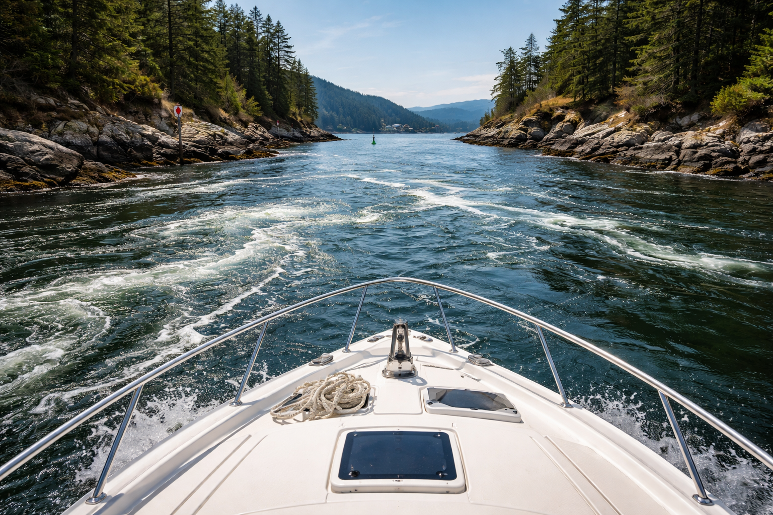
Current ripples in a tidal channel — time your passage right and the water works with you
The Tools That Make This Easy
You don’t have to memorize anything — the tools do the work. NOAA’s Tides and Currents website (tidesandcurrents.noaa.gov) gives you free, accurate tide tables and current predictions for thousands of stations around the US. Apps like Navionics, PredictWind, and Garmin ActiveCaptain put tide and current data directly on your chart so you can plan visually. Most of these apps will overlay current arrows on your chart showing you the direction and strength of tidal flow at different times — which is exactly what you need for planning a departure or timing a tricky inlet crossing. Good route planning is part of staying safe on the water, and tides are one of the factors most boaters underestimate before they’ve been burned by one.
Check tides the night before, verify them the morning of your departure, and factor current into your passage plan as a matter of habit. It takes five minutes and it’s the kind of thing that separates captains who have close calls from captains who don’t.
Tides and currents reward the skipper who takes the time to understand them and punish the one who doesn’t. Once you make checking them part of your pre-departure routine, it becomes second nature — and you’ll find yourself arriving with the current, anchoring with confidence, and spending a lot less time fighting the water. That’s what seamanship is supposed to feel like.
